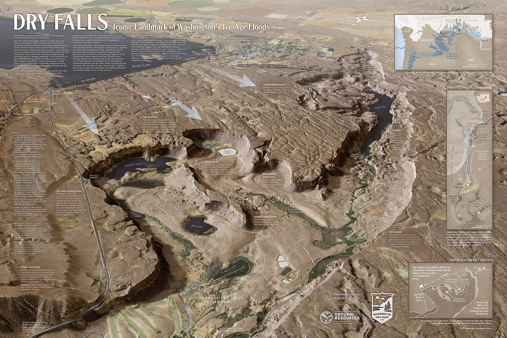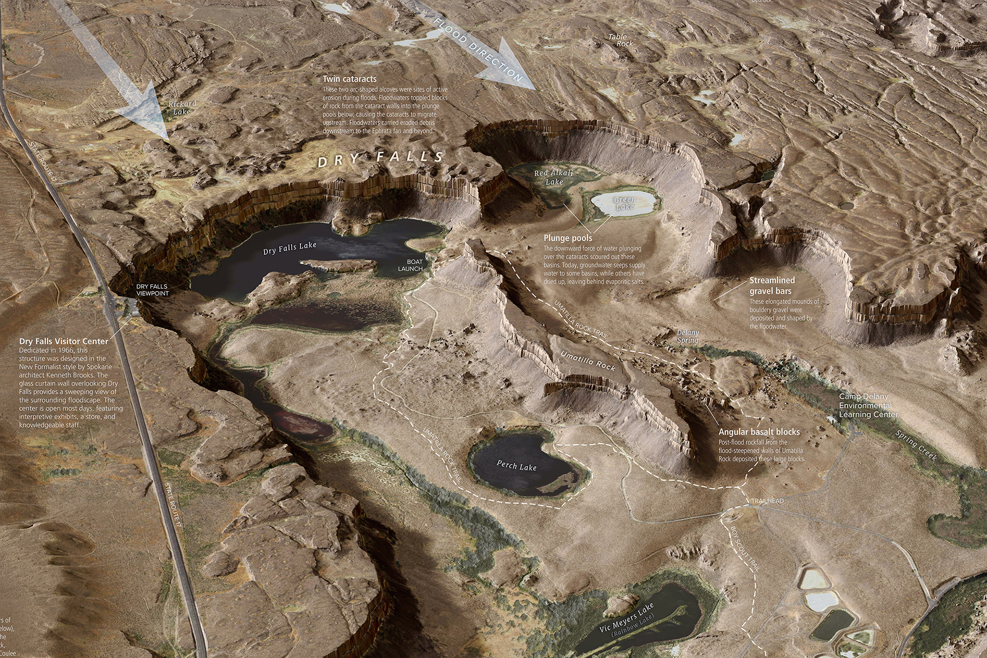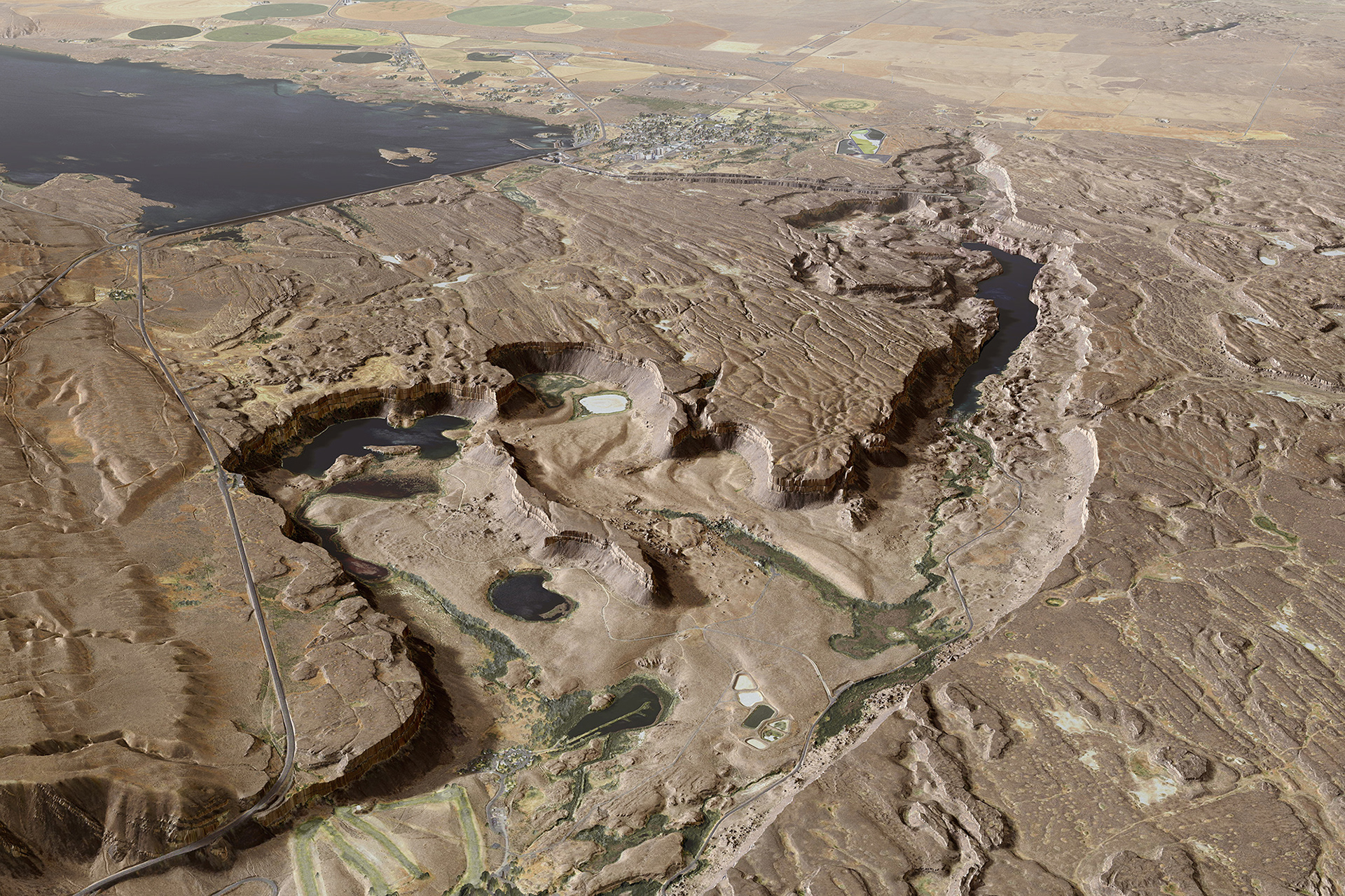
Dry Falls—Iconic Landmark of WA's Ice Age Floods
Dry Falls, in Washington State’s Channeled Scablands, is one of the most geologically significant sites in the Pacific Northwest. The eroded landscape at this iconic location bears evidence of catastrophic glacial outburst floods from the last ice age. This interpretive map provides a bird’s eye view of the huge landforms at Dry Falls. This map was a collaboration with Joel H. Gombiner for the Washington Geological Survey.