![](https://cdn.myportfolio.com/44b8374c-5758-4aa0-b67e-1a860c4711e6/9905dcee-50ac-4c30-88b7-027a998b196d_rw_1920.jpg?h=e9a321382978b7bf4c6bb80f6a7003ae)
![](https://cdn.myportfolio.com/44b8374c-5758-4aa0-b67e-1a860c4711e6/391438cb-5210-4967-b0c4-2facc6e93c43_rw_1200.png?h=6d46147b0f4620d49adb923ca71be3b1)
![](https://cdn.myportfolio.com/44b8374c-5758-4aa0-b67e-1a860c4711e6/6d9eddbb-5050-4220-ac23-1152aeaca208_rw_1200.png?h=566895a00c9eca3a84d0c934a9c6d8b7)
![](https://cdn.myportfolio.com/44b8374c-5758-4aa0-b67e-1a860c4711e6/18c78fc3-7085-4f6d-bd84-a4cc10bced57_rw_1200.png?h=f9a3f4e0c95e89fe6d2698c442b57aac)
![](https://cdn.myportfolio.com/44b8374c-5758-4aa0-b67e-1a860c4711e6/e47ad3eb-99c2-42d7-bca1-249ecfa7aa82_rw_1200.png?h=c4e325708369421a70bf0510f27b272c)
![](https://cdn.myportfolio.com/44b8374c-5758-4aa0-b67e-1a860c4711e6/934f3cc7-c499-4596-ba80-26fb601c035a_rw_600.gif?h=50ac6b4be043356b357db958589568a7)
![](https://cdn.myportfolio.com/44b8374c-5758-4aa0-b67e-1a860c4711e6/4971e13b-4868-4c7a-95de-937aa2b1d29b_rw_1200.png?h=312787155c40d18f08c69f2af26f4c0c)
Cedar River landslide, aerial photograph
![](https://cdn.myportfolio.com/44b8374c-5758-4aa0-b67e-1a860c4711e6/587b84b4-9edc-4387-9819-32de588ec19f_rw_1200.png?h=38db54112bf9946722376fe8224ca426)
Cedar River landslides, lidar image
![](https://cdn.myportfolio.com/44b8374c-5758-4aa0-b67e-1a860c4711e6/0e33e0f4-b69b-4037-854c-cbde7f0c0946_rw_1200.png?h=b1d208949cc4549112697c2b07d1bb96)
![](https://cdn.myportfolio.com/44b8374c-5758-4aa0-b67e-1a860c4711e6/d37f67b0-add6-4ab7-b350-c733cb7f8e3b_rw_1200.png?h=05471204a0b6810fac50952037e5bf9b)
![](https://cdn.myportfolio.com/44b8374c-5758-4aa0-b67e-1a860c4711e6/670193ee-b125-4356-bccf-2825f039cad7_rw_1200.png?h=cd1fe06c4df23901b3b48d7c5506a5bb)
![](https://cdn.myportfolio.com/44b8374c-5758-4aa0-b67e-1a860c4711e6/1087672d-d6ad-447f-a60b-3e5870b9a710_rw_1200.png?h=7e761cf7f566ac05cb6c0b5aafba3028)
![](https://cdn.myportfolio.com/44b8374c-5758-4aa0-b67e-1a860c4711e6/3035eb7b-0baa-4d24-bdc5-7190dfbc5b6e_rw_1200.gif?h=d683ed17a738007dcd6f9ce6350c8271)
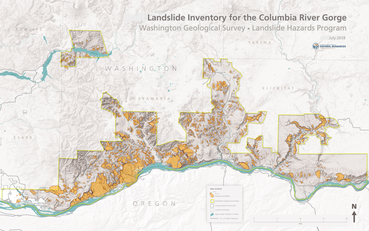
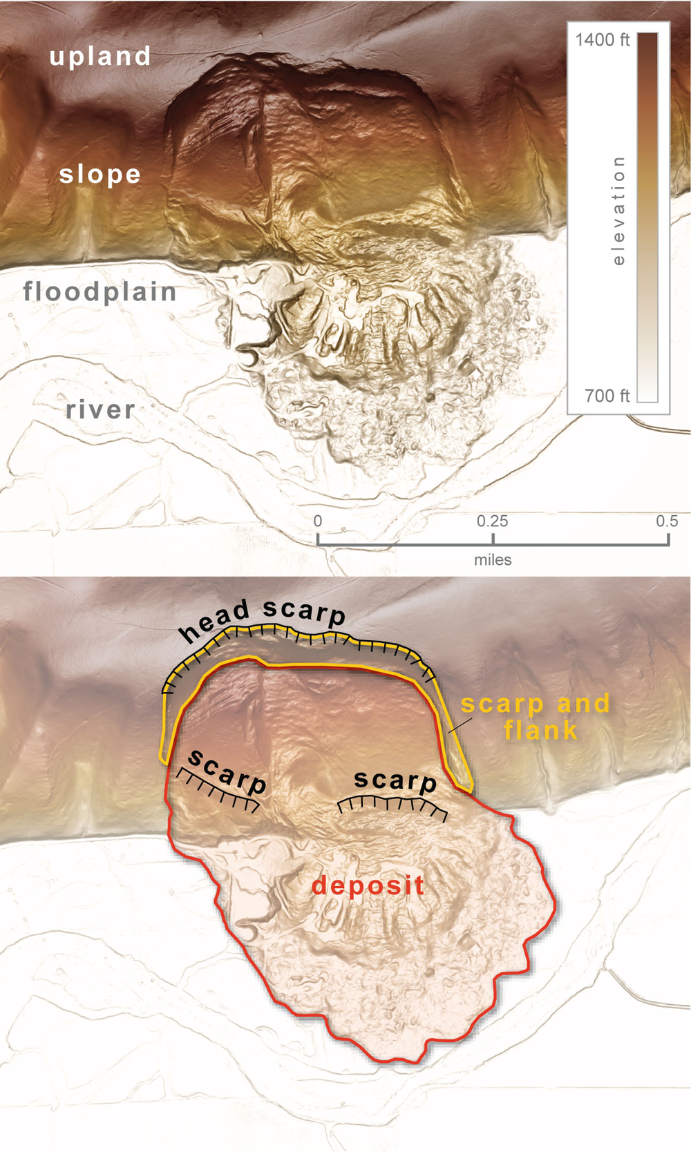
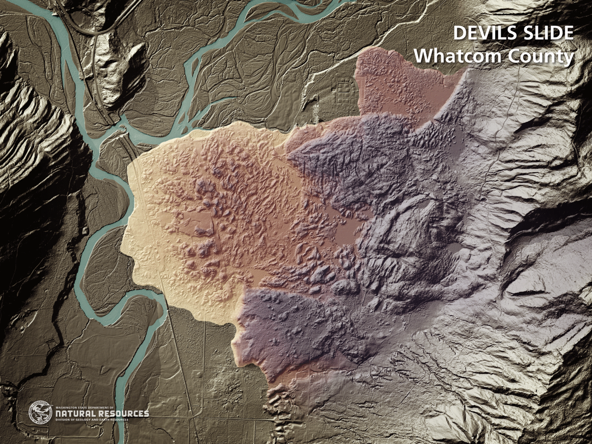
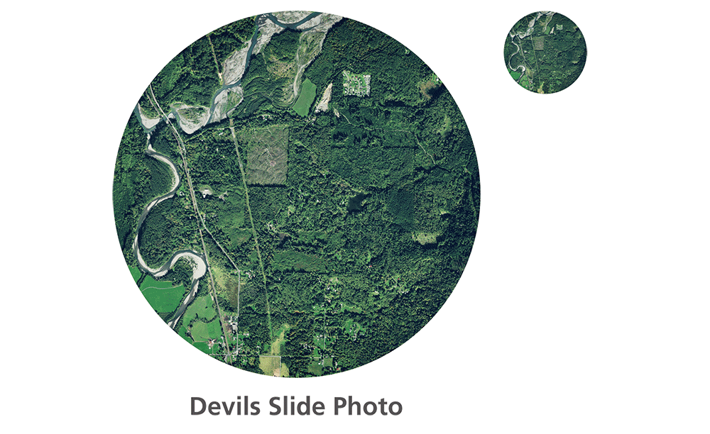
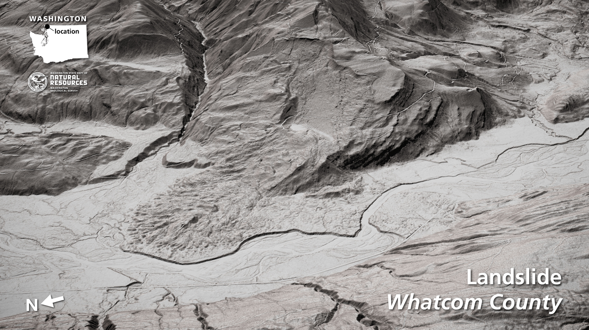
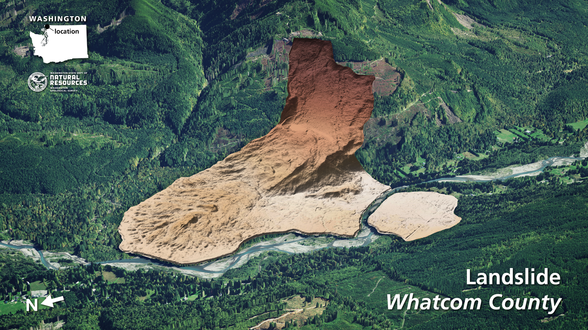
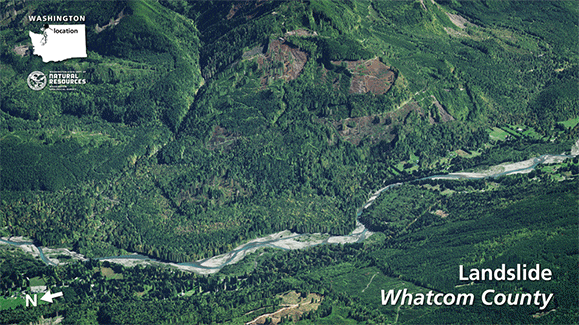
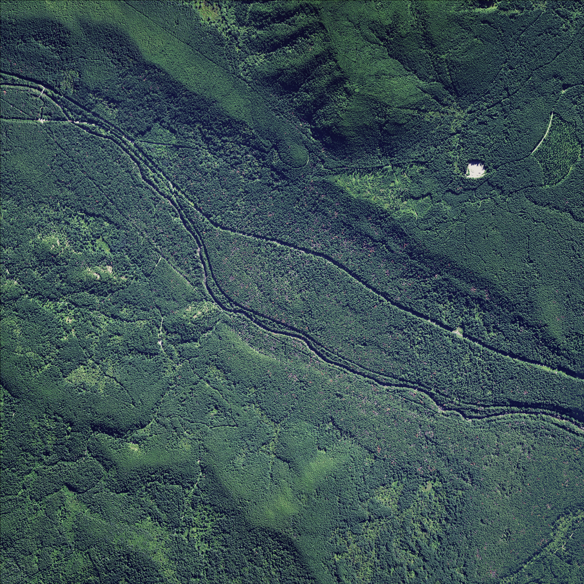
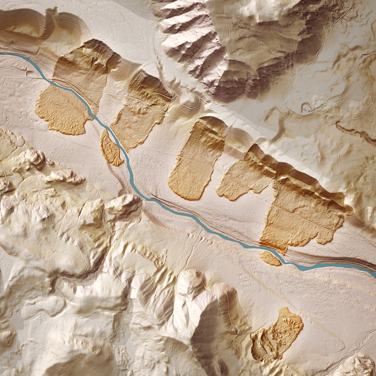
The combination of steep slopes and high precipitation make landslides a very common natural hazard in the Pacific Northwest and lidar is a very valuable tool in mapping past landslides and identifying future landslide hazards. Below are several lidar-derived maps and images of landslides made to support Washington Geological Survey's Landslide Hazards Program
Cedar River landslide, aerial photograph
Cedar River landslides, lidar image