![](https://cdn.myportfolio.com/44b8374c-5758-4aa0-b67e-1a860c4711e6/de4196a5-1aad-46e5-b58b-396203903c96_rw_1200.jpg?h=15fc1ec0f1e7d322a8698eacf7f715e0)
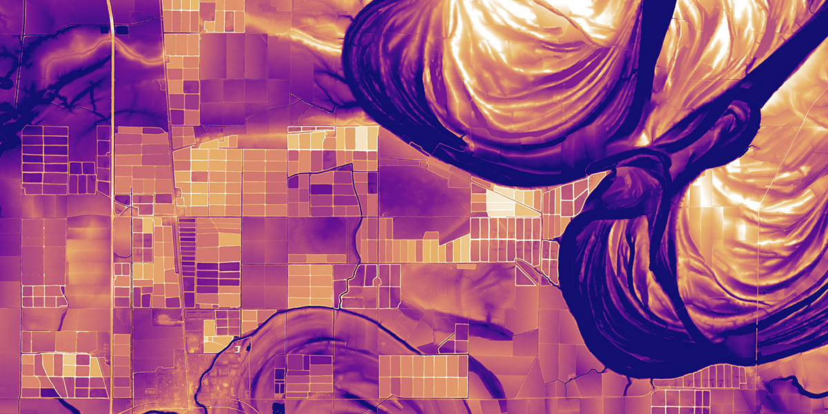
Meander scars near Swiftown, Mississippi, on the Mississippi River Alluvial Plain. These are over 40 miles east of the Mississippi River itself.
![](https://cdn.myportfolio.com/44b8374c-5758-4aa0-b67e-1a860c4711e6/6004ff5a-2acb-4603-8d1e-42894d6502e6_rw_1200.jpg?h=d17943f578cb3c3d3333085276991e89)
December, 2019 issue of National Geographic Magazine.
![](https://cdn.myportfolio.com/44b8374c-5758-4aa0-b67e-1a860c4711e6/6aed1854-2732-4b4c-bf1f-8c53e85ad065_rw_1200.jpg?h=c9bc382b5e22862d14235dbed71e4a3f)
Oxbow lakes, scroll bars, and levees along the Mississippi River on the border of Arkansas and Mississippi.
![](https://cdn.myportfolio.com/44b8374c-5758-4aa0-b67e-1a860c4711e6/34b3e4f5-bf1d-486c-b839-17c30489386a_rw_1200.jpg?h=9603c4e5b7206594b8c573c454fa67b5)
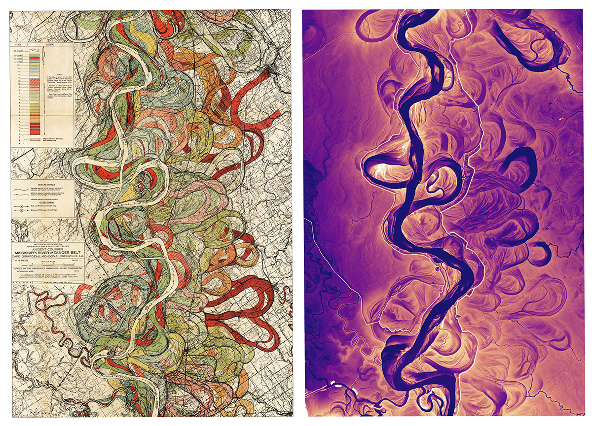
Comparison of Plate 7 from Harold Fisk's 1944 report "The Alluvial Valley of the Lower Mississippi River" with a modern-day lidar derived image of the same area.
![](https://cdn.myportfolio.com/44b8374c-5758-4aa0-b67e-1a860c4711e6/ae9defc1-312c-4850-a612-3b5521c500ee_rw_1200.jpg?h=9bab67633fa2c1626b35b4dc660dd1ce)
Wax Lake Delta, Louisiana. This growing delta on the Gulf of Mexico is the result of a man-made channel that
drains part of the Atchafalaya River, a distributary of the Mississippi River.
![](https://cdn.myportfolio.com/44b8374c-5758-4aa0-b67e-1a860c4711e6/1d92f4f2-1f2b-463c-afba-384877f68e83_rw_1200.jpg?h=ef2a14e87adf739876da2d4c5d7627fa)
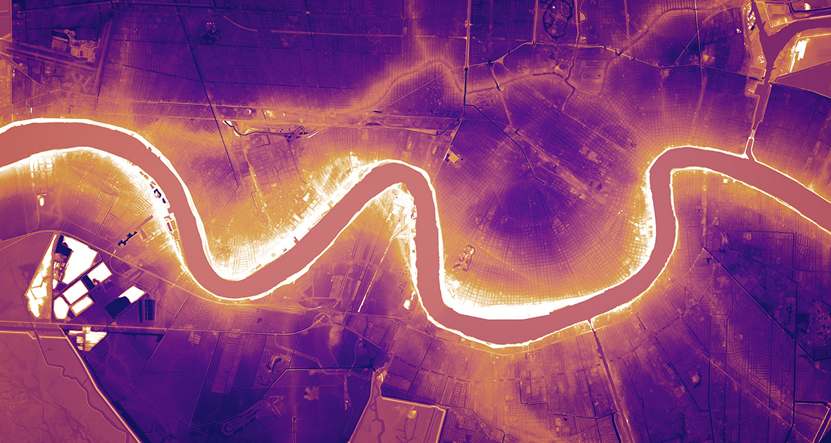
New Orleans, Louisiana. This image highlights the fact that the Mississippi River is at a higher elevation than many parts of the surrounding city.. The levees glow bright white along the river. Dark colors=lower elevations, light colors=higher elevations.
![](https://cdn.myportfolio.com/44b8374c-5758-4aa0-b67e-1a860c4711e6/8f9d1fa0-4264-47da-bc57-0e83b1684492_rw_1200.jpg?h=15ba94100ca1e7fcffbb1442fad30cbf)
Flooded fields and meander scars near Moorhead, Mississippi.
![](https://cdn.myportfolio.com/44b8374c-5758-4aa0-b67e-1a860c4711e6/565a8238-0559-4951-a69d-c38cf3838db6_rw_1200.jpg?h=c4365dcab6db6957be3509cb07351d6f)
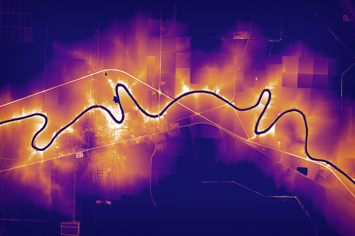
The community of Hollandale, Mississippi along Deer Creek on the Mississippi River Delta.
![](https://cdn.myportfolio.com/44b8374c-5758-4aa0-b67e-1a860c4711e6/588ad1ad-564f-414b-b7c1-f8f13dc503fe_rw_1200.jpg?h=9f8f1b8d888cf0ac6cd8e3f28b2fd37a)
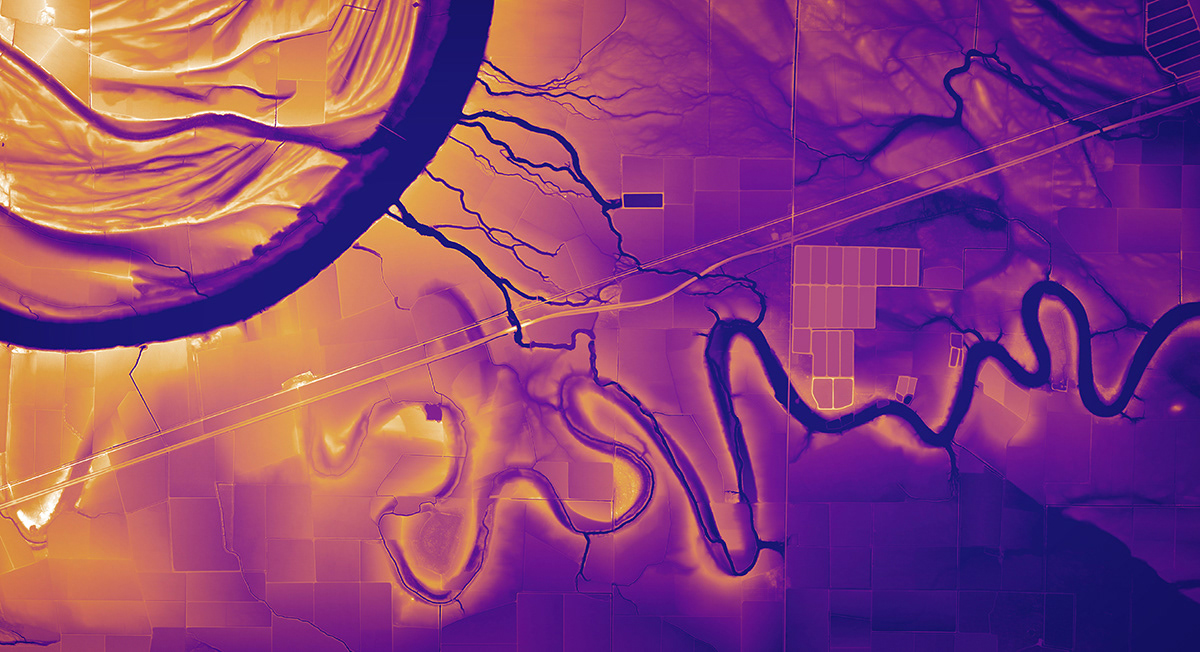
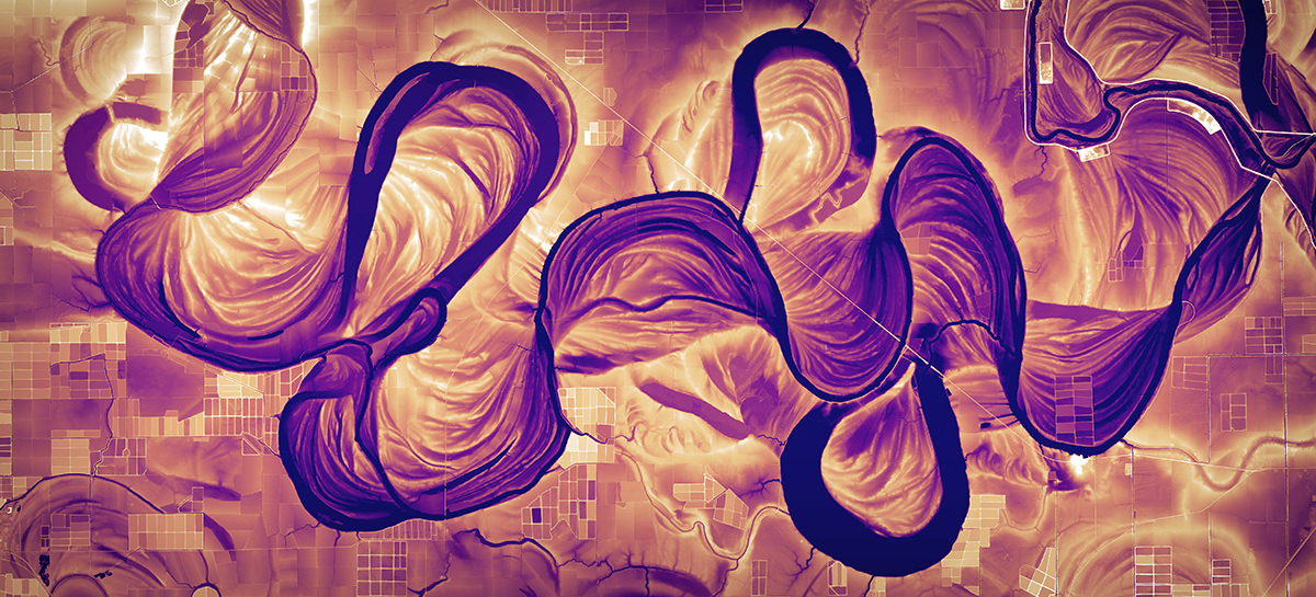
A landscape shaped by water in Chicot County, Arkansas, just to the west of the Mississippi River—Bayou Macon is on the left and US Highway 65 cuts across the image diagonally.
![](https://cdn.myportfolio.com/44b8374c-5758-4aa0-b67e-1a860c4711e6/902756a7-0d79-47a6-8e9a-a6edc221c0c6_rw_1200.jpg?h=4318c591c0828db8f5aed04d98dd357e)
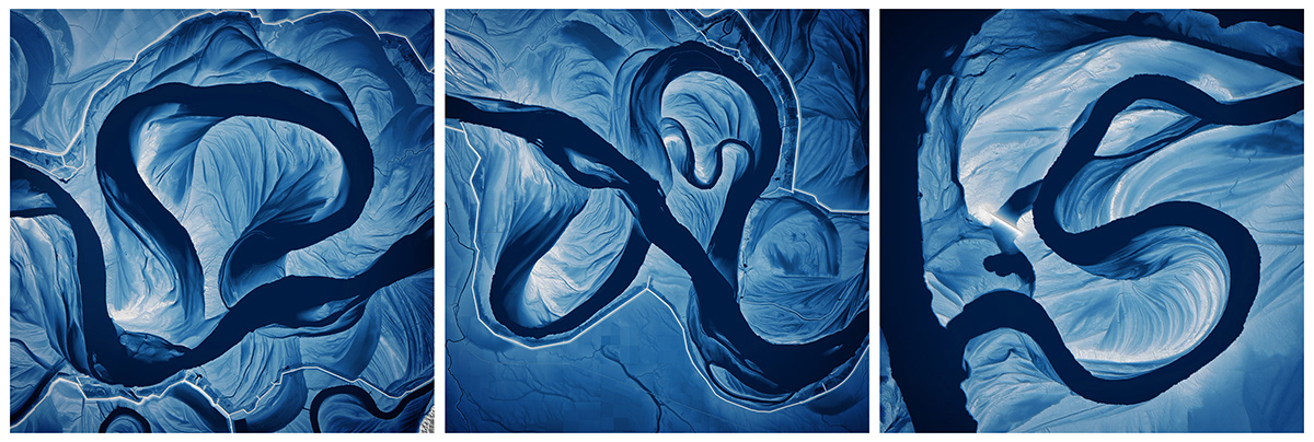
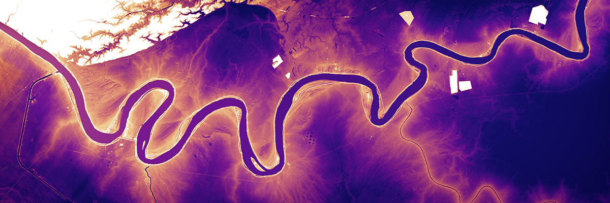
Meander scars along the Saint Francis River in Arkansas.
![](https://cdn.myportfolio.com/44b8374c-5758-4aa0-b67e-1a860c4711e6/c65d2859-05b8-4cb0-83b3-15ed72c06509_rw_1200.jpg?h=3a7b8aa33352e16ba76093bff5616f75)
The Mississippi River from Baton Rouge, LA to St James, LA displaying about ten meters of elevation range.