
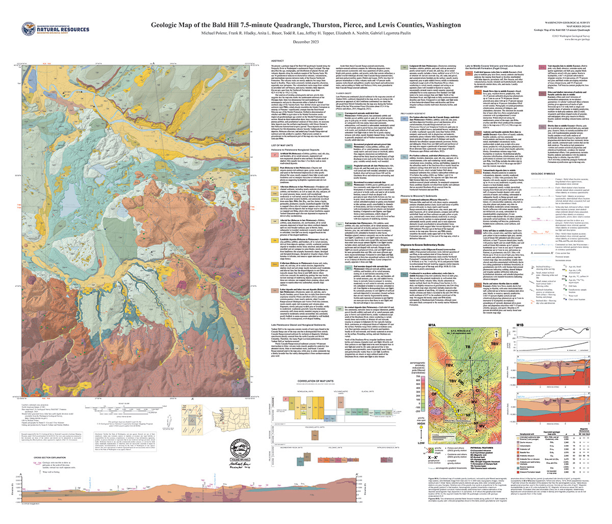
Geologic Map of the Bald Hill 7.5-minute Quadrangle, Thurston, Pierce, and Lewis Counties, Washington, by Michael Polenz and others, Washington Geological Survey, 2023.
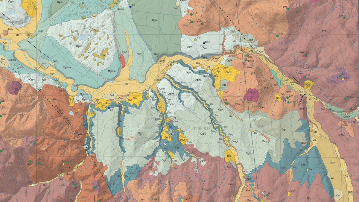
Geologic Map of the Bald Hill 7.5-minute Quadrangle, Thurston, Pierce, and Lewis Counties, Washington, by Michael Polenz and others, Washington Geological Survey, 2023 (detailed view).
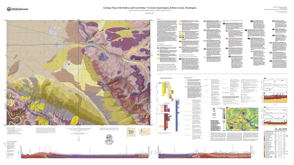
Geologic Map of the Kittitas and East Kittitas 7.5-minute Quadrangles, Kittitas County, Washington, by Andrew J. Sadowski and others, Washington Geological Survey, 2023.
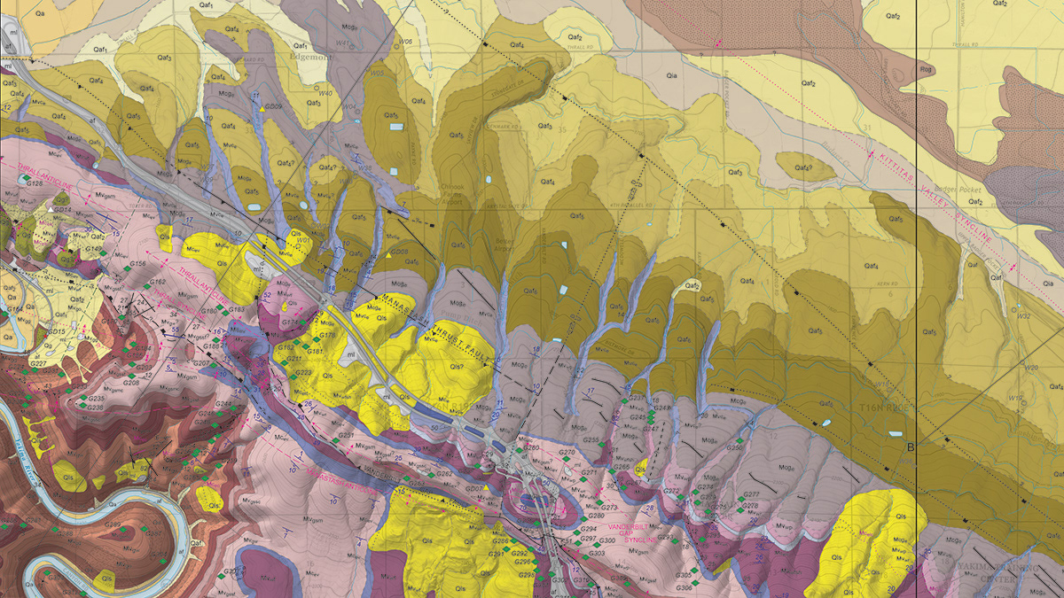
Geologic Map of the Kittitas and East Kittitas 7.5-minute Quadrangles, Kittitas County, Washington, by Andrew J. Sadowski and others, Washington Geological Survey, 2023 (detailed view).
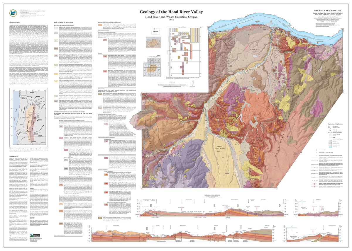
Geologic Map of the Hood River Valley, Hood River and Wasco Counties, Oregon, by Jason D. McClaughry and others, Oregon Department of Geology and Mineral Industries, 2012.
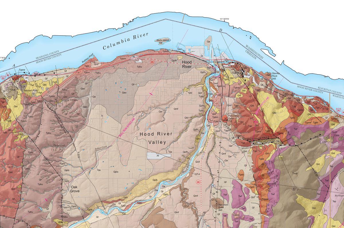
Geologic Map of the Hood River Valley, Hood River and Wasco Counties, Oregon, by Jason D. McClaughry and others, Oregon Department of Geology and Mineral Industries, 2012 (detailed view).
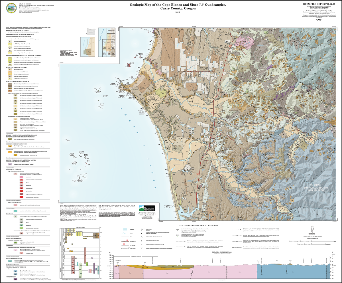
Geologic Map of the Cape Blanco and Sixes 7.5-minute quadrangles, Curry County, Oregon, by Thomas J. Wiley and others, 2014.