
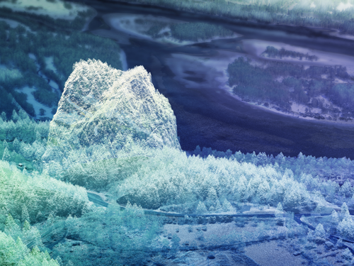
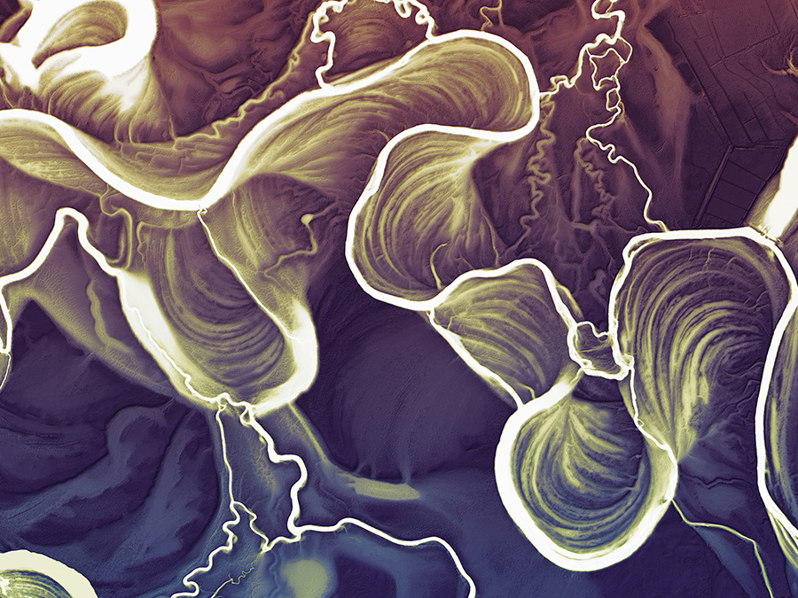
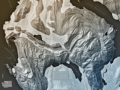
Washington Lidar Images
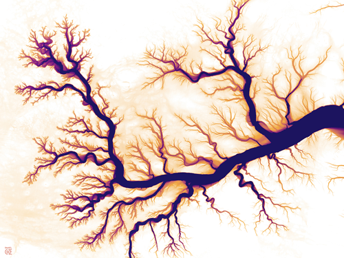
4K Rivers
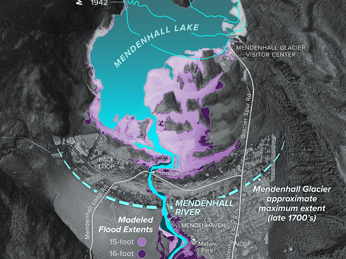
Mendenhall River Glacial Outburst Flooding
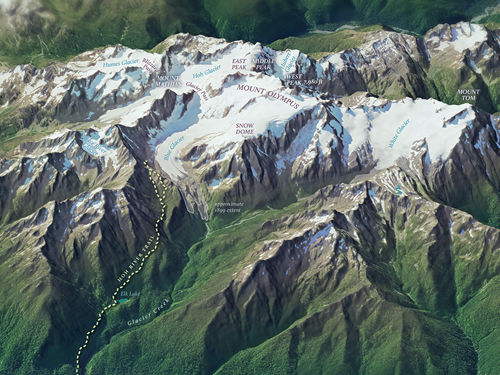
Mount Olympus–Wild Heart of the Olympic Mountains
Washington 100 Website Graphics
Glacial Landforms of the Puget Lowland

Dry Falls—Iconic Landmark of WA's Ice Age Floods
Cascade Volcanoes
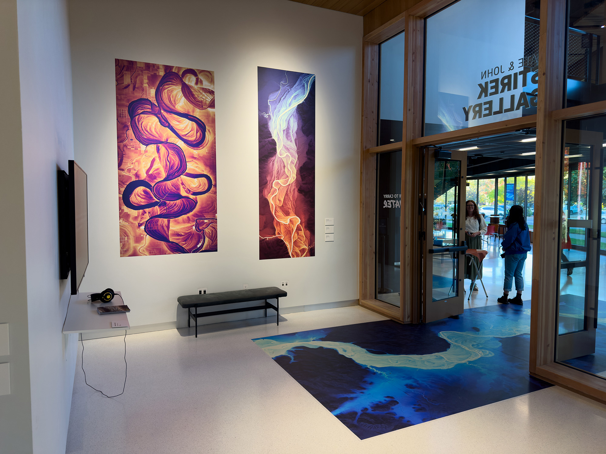
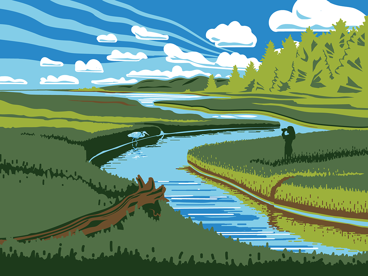
How to Carry Water
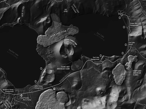
Newberry Caldera

The Bare Earth
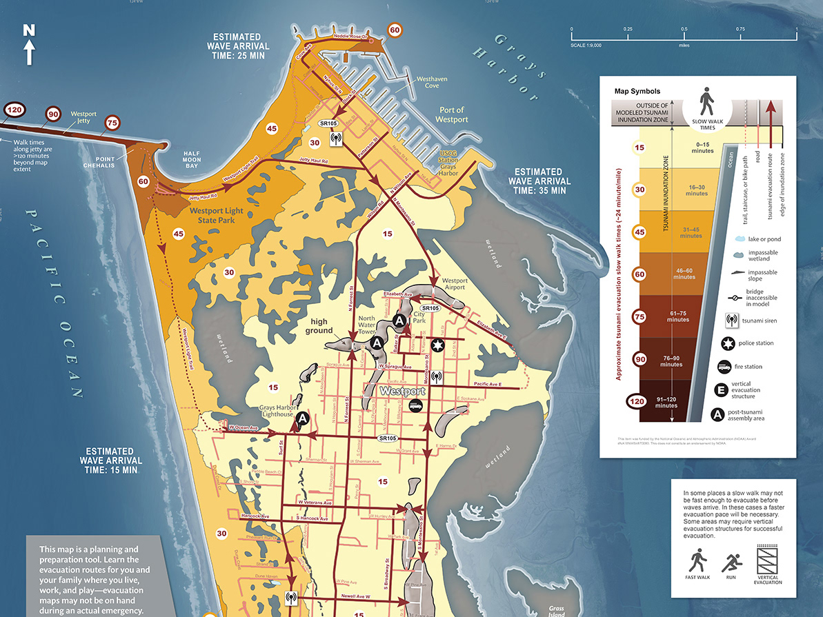
Tsunami Evacuation Walk Times
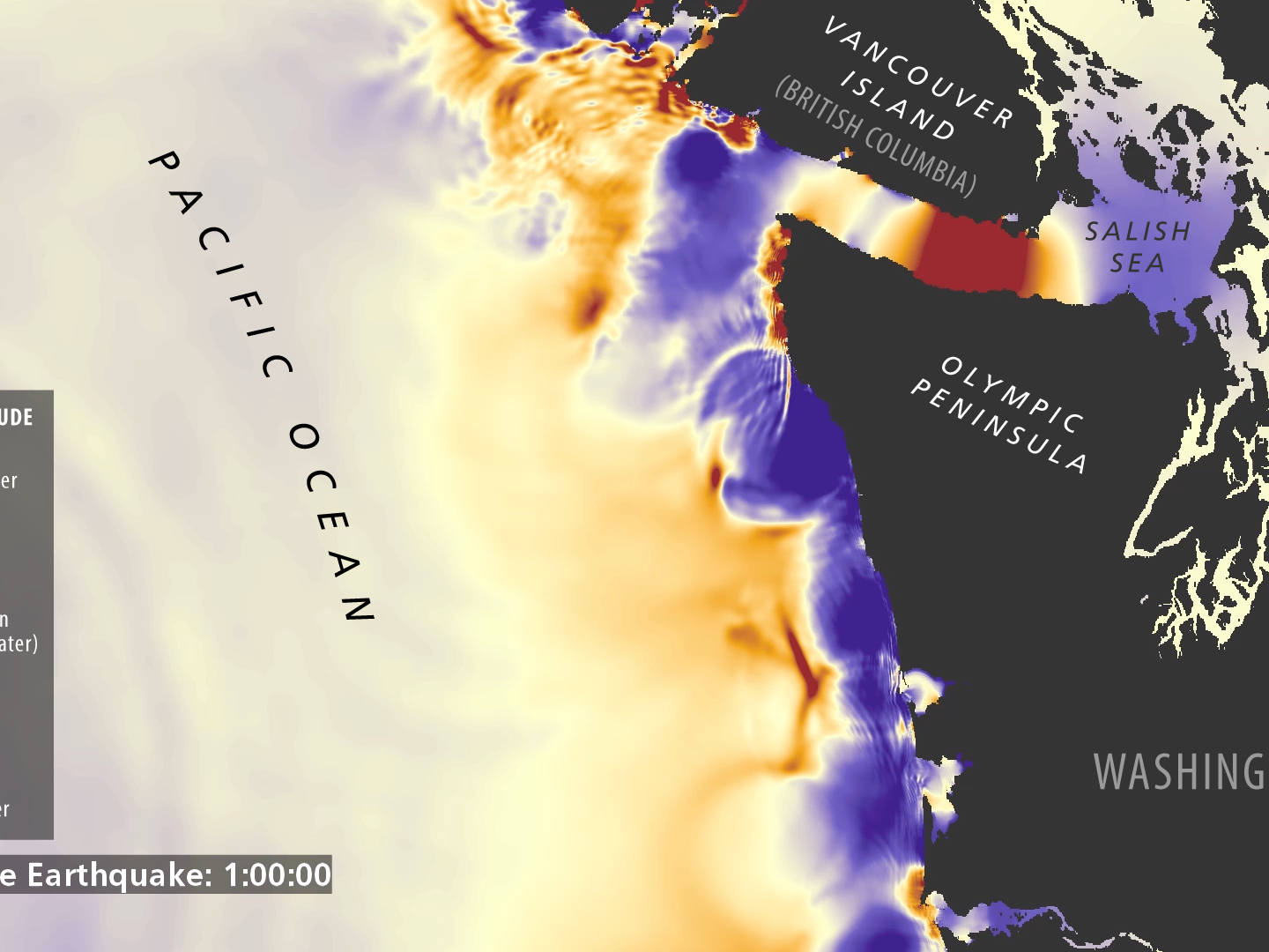
Washington Tsunami Simulations
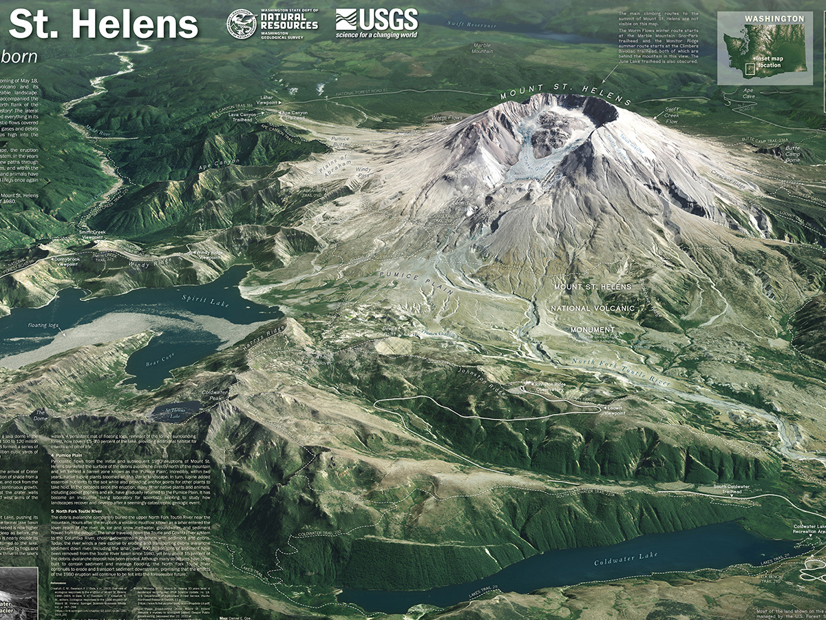
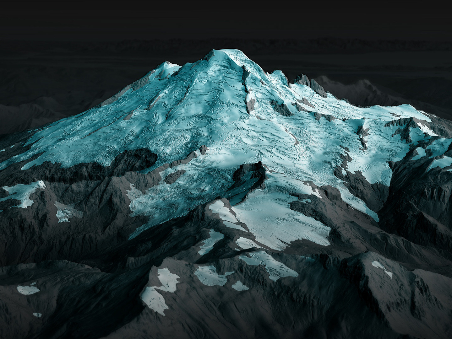
Mount St. Helens—A Mountain Reborn

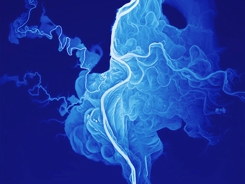
Lena River Delta
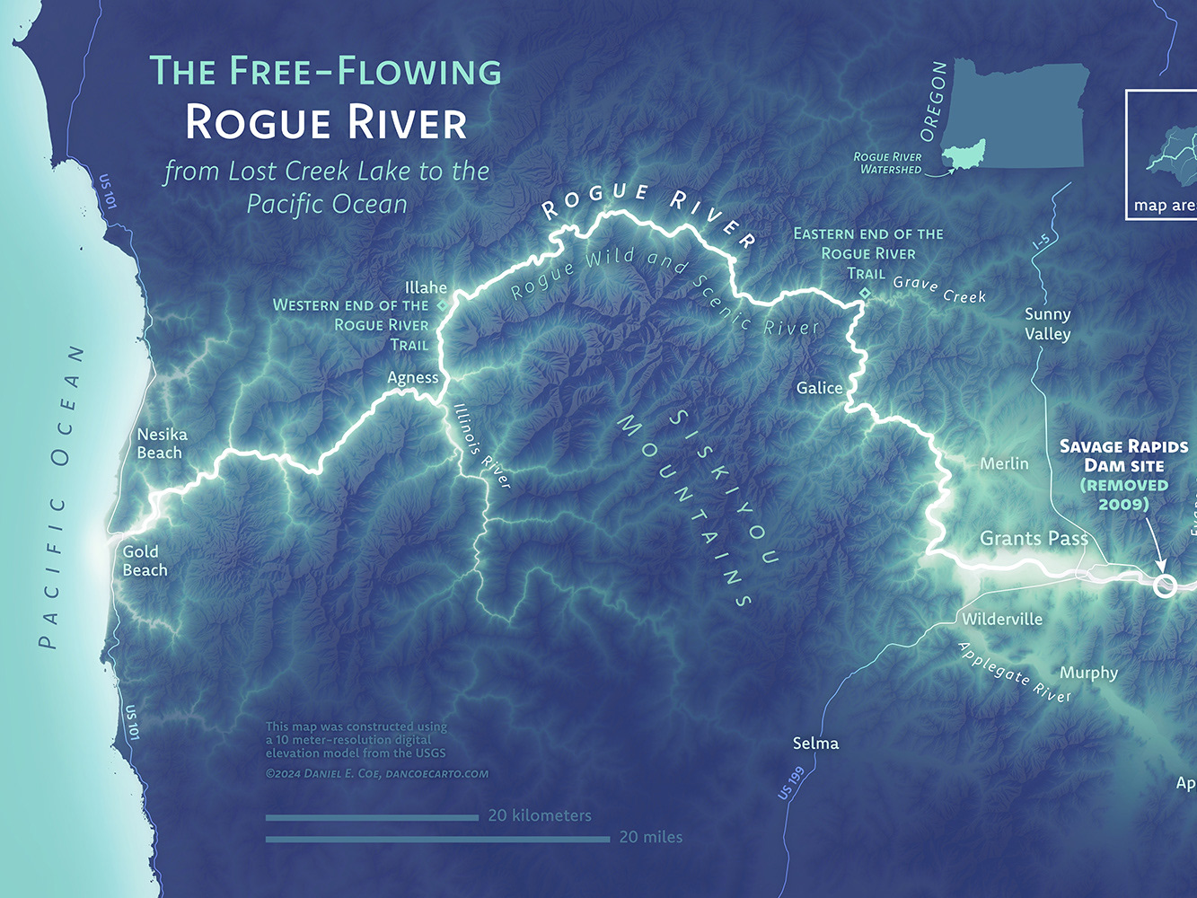
The Free-Flowing Rogue River
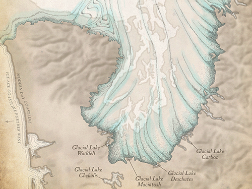
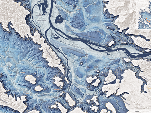
Puget Lobe Glacial Lakes
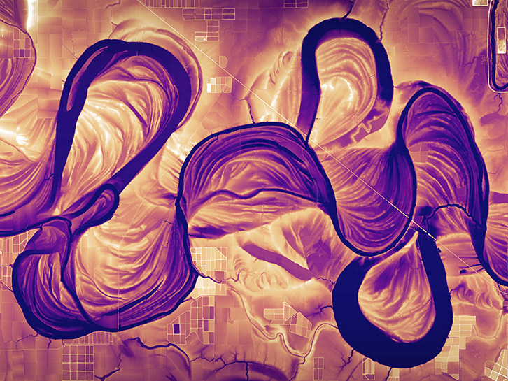
Alaska Rivers

Portlandness: A Cultural Atlas
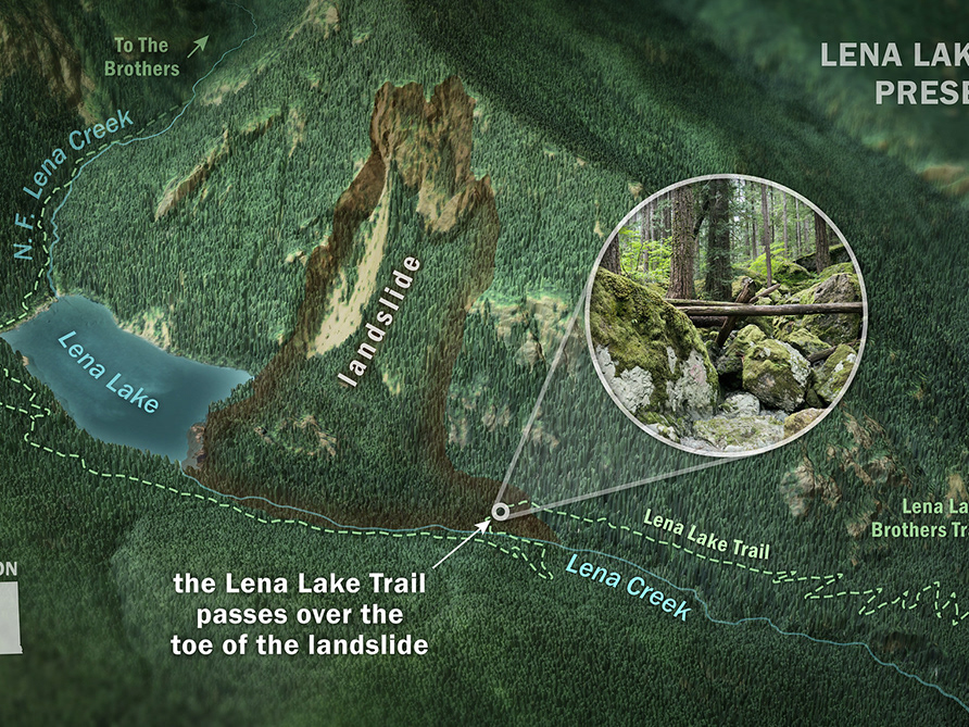
Lena Lake Landslide
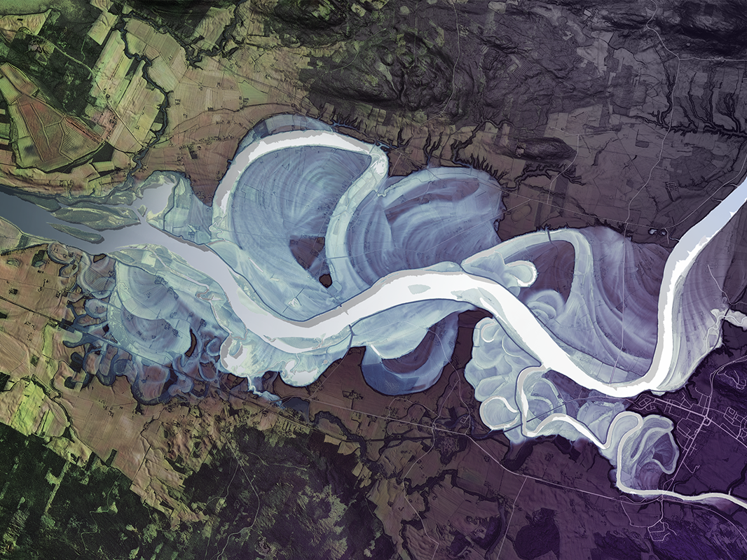
Mississippi River Lidar
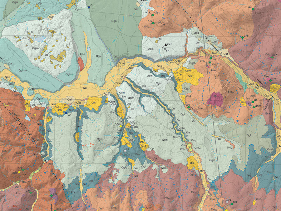
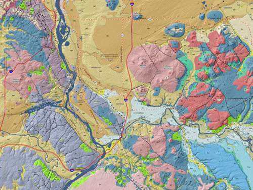
STATEMAP Geologic Maps
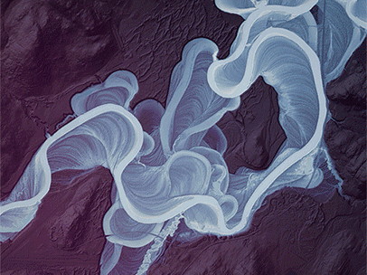
Ivalo River Geomorphology
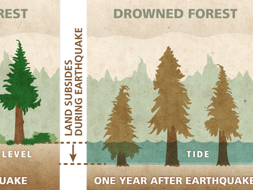
Coastal Earthquake Subsidence–Ghost Forest
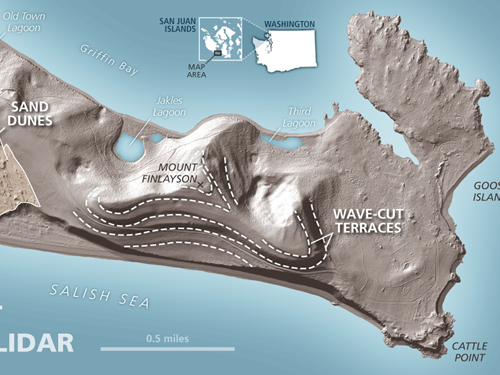
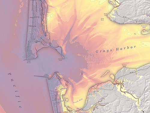
San Juan Islands Wave-Cut Terraces
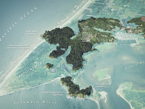
Cape Disappointment Modeled Tsunami Inundation
Post-Wildfire Debris Flows
Glåma—Norway—A River Vignette
Folds and Fossils of the Chuckanut Formation

Mississippi River Comparison
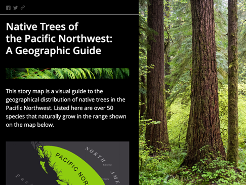
Native Trees of the Pacific Northwest
Colorado River Delta

GIS for Science, Cover and Chapter
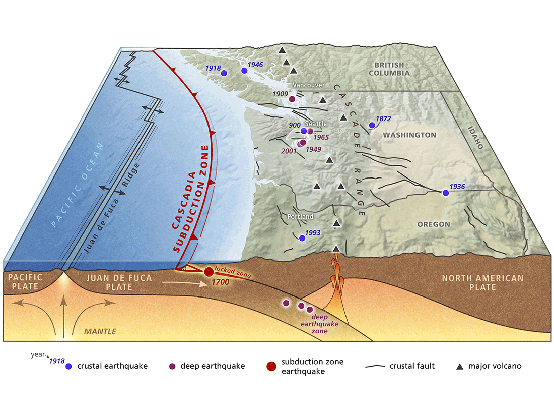
Cascadia Subduction Zone Graphics
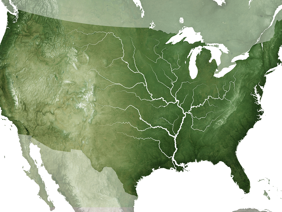
Mississippi River Basin and Louisiana Delta Plain
Oregon Lidar Images
Tsunami Inundation and Current Velocity
NACIS Tacoma
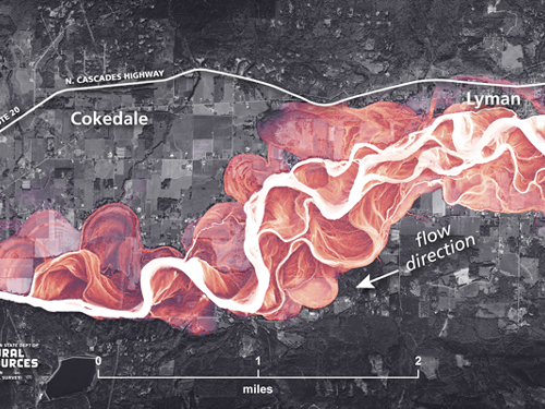
Skagit River Channels
Earth Science Week
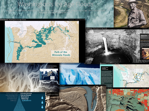
Washington's Ice Age Floods
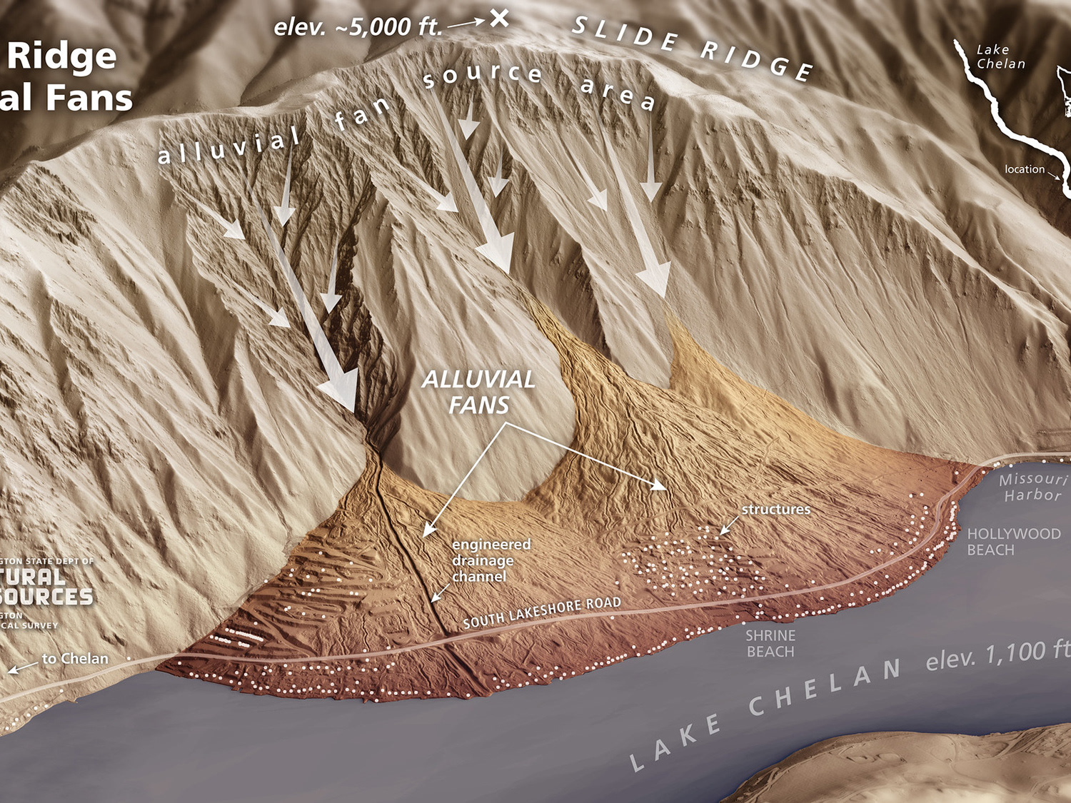
Alluvial Fan Maps and Graphics
Missoula Floods in Portland, Oregon
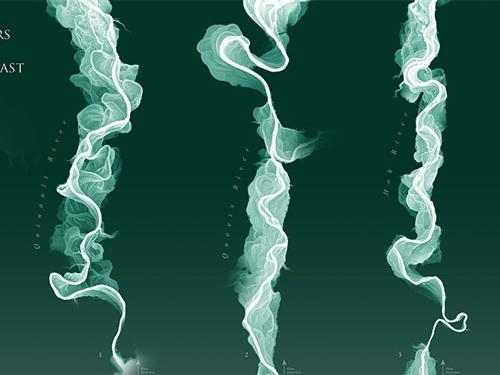
Rainforest Rivers of the Outer Olympic Coast
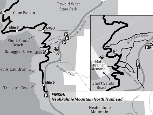
Oregon Coast Trail Guide

AEG Nisqually Chapter Logo
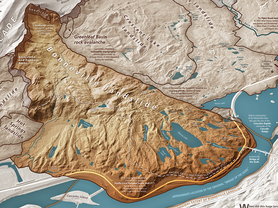
Bonneville Landslide–Bridge of the Gods
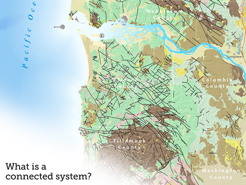
Washingtons
Surficial Geology of Portland, Oregon
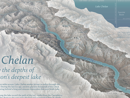
Lake Chelan–Washington's Deepest Lake

Township and Range Restaurant
Cascade Volcano Illustrations
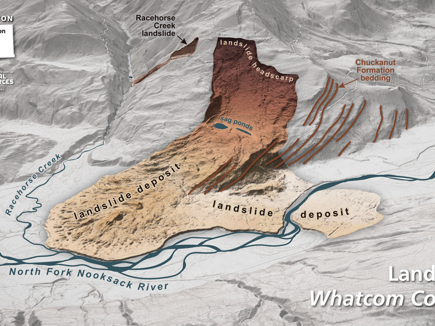
Landslide Maps and Graphics
Willamette River Channels
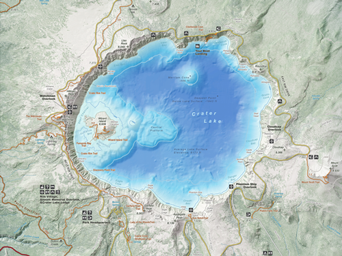
Crater Lake Geologic Guide and Recreation Map
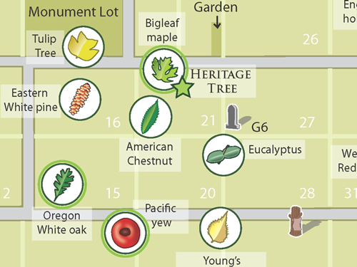
Lone Fir Cemetery Tree Identification Maps
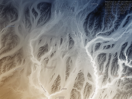
Cheney-Palouse Channeled Scablands